Nexus in Mahanadi Delta: Thriving Sustainable Wetlands, Resilient Communities and Economies
-
Capacity development
-
Community resilience
-
Species
The Mahanadi Delta, situated in the eastern part of India, is a region of ecological significance, hosting a diverse array of ecosystems and supporting both human and natural communities. The delta is formed by the convergence of the Mahanadi River and the Bay of Bengal, creating a dynamic landscape of mudflats, marshes, mangroves, estuaries, islands, and tidal channels. The intricate balance of ecological processes in the Mahanadi Delta contributes to its rich biodiversity and the livelihoods of the people who depend on its resources.
Wetlands International South Asia places a high priority on the conservation and management of these intricate threads created by the delta. A field expedition was undertaken under the aegis of the “Wetlands for Resilience” and the “4 Returns” project by Nikita Mishra (Junior Technical Officer – Knowledge Base Development), Pradeep Vashisht (Technical Officer – GIS and Remote Sensing), Harsh Ganapathi (Senior Technical Officer – Ecohydrology) and Ravi Prakash (Wetlands Specialist) during 27th October to 2nd November to gain a comprehensive understanding of the complex relationship of the deltaic landscape and its communities. The mission encompassed a thorough examination of the landscape, with particular attention to ecological aspects, cultural elements, economic factors, and historical transformations within the delta.
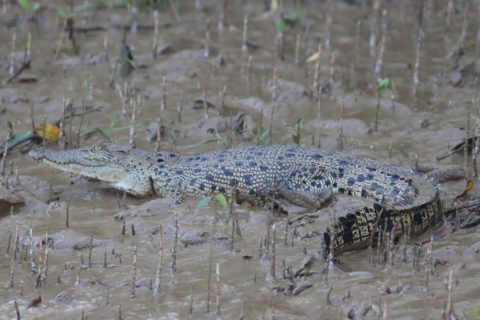
(Nearly 1700 saltwater crocodiles inhabit the rivers and creeks of Bhitarkanika)
During the mission the team visited notable areas in the Delta like Bhitarkanika Mangroves, Chilika lagoon, Salia Dam, Puri and Konark. Discussions were held in Bhitarkanika landscape with the Divisional Forest Officer (DFO) Rajnagar, members of Animal and Plant Welfare Association (APOWA) and Palishree that highlighted the significance of mangroves in protecting parts of the landscape from cyclones. Notably, mangroves were strategically introduced to replace evicted aquaculture lands, aligning with sustainable ecological practices. Site visits to Badakota and Jaganathpur unveiled the community’s unwavering dedication to mangrove plantation, marked by active women’s participation and innovative utilization of Naadia grass for value-added products. Field discussions with representatives from Pallishree shed light on innovative rice farming techniques and mangrove plantation initiatives in the area. The exploration extended to Bhitarkanika National Park, providing valuable insights into the thriving ecosystem of Kanika Island inhabited by saltwater crocodiles, monitor lizards, and various other wildlife species.
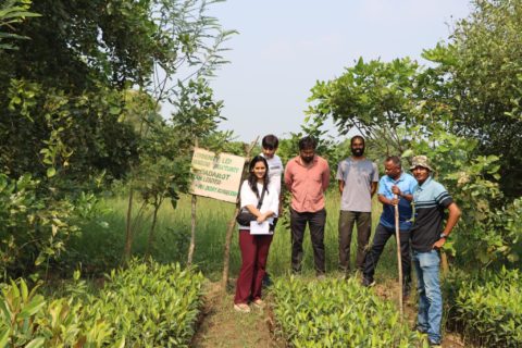
(Community led mangrove plantation at Badkot)
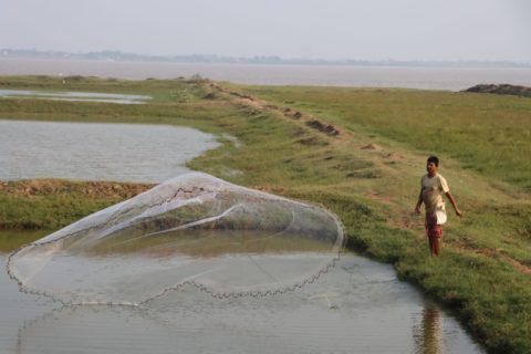
(Fishery and aquaculture is one of the major livelihoods in the Mahanadi Basin)
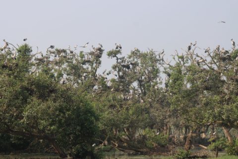
(Bhitarkanika is known to have one of the largest heronries in the South Asian region)
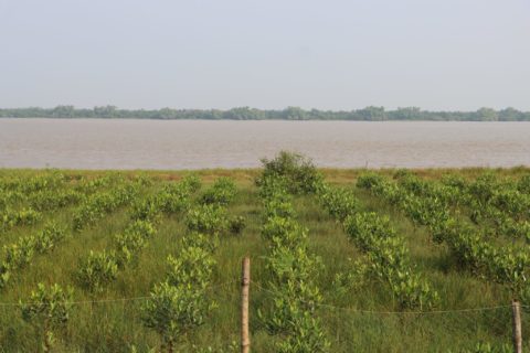
(Forest department planted mangroves in the decommissioned aquaculture farms along the Baitarani River)
Subsequently, the team also held discussions with representatives of the Chilika Development Authority (CDA), District Fishery Office (DFO) Khorda, Fishery Association and Tour Guides in Manglajodi. The Nalaban Island and Manglajodi emerged as bastions of rich birdlife, each possessing its own ecological significance. Strong emphasis was given on means to transform invasives like water hyacinth and phragmites into value-added products to maintain wetland health and also generate alternate livelihood to the localities. Discussions in Mangalajodi brought to light the evolving ecosystems, environmental challenges, and the escalating impact of tourism in the region. Valuable insights were gleaned into changing landscapes, evolving tourism trends, and ongoing disaster management efforts in the Ganjam district.
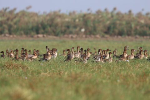
(Abundance of avifauna found the Mangalajodi, Chilika)
The expedition also ventured into Tampara, where application of nature-based solutions (NBS) for disaster management was observed, focusing on securing Olive Ridley turtle nesting habitats, plantation efforts for buffering coastal storms, and dune restoration to counteract soil erosion. The Acacia Cashew Nut Plantation by NetCoast, comprising approximately 3,000 trees stood out as a good storm buffer and crab cultivation in dilapidated aquafarms as sustainable livelihood initiative in the Tampara and Rushikulya delta region.
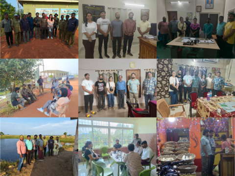
(Glimpses of landscape stakeholders’ interaction)